Written by: John Keay
Submitted By: Janice Christopher
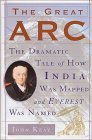
In 1800 a man named William Lambton inaugurated one of the most stupendous scientific projects of the 19th century: the Great Trigonometrical Survey of India, the goal of which was the exact measurement of what became known as the Great Indian Arc of the Meridian, spanning 1600 miles of subcontinent from Cape Comorin in the south to Dehra Dun and Mussoorie [Masuri] near the present border with Nepal in the north. The longest direct measurement of the earth's surface ever undertaken, the project spanned nearly fifty years. Lambton would die before its end. His successor, George Everest, looked beyond the Arc to the imperious heights of the Himalayas, and under his direction the Survey would continue on after the completion of the Arc to measure the heights of all the major Himalayan peaks, including "a shy and partly obscured giant," the highest mountain in the world, which in 1856 would be dubbed Mount Everest. (The Survey's 1850 result of 29,002 feet for Mount Everest is only a hair off the generally accepted 'modern' value of 29,028 feet--a difference of about 0.0009%, if my math is correct.) Of greatest relevance to Sharpe fans is the second chapter of the book, "The Elusive Lambton." After serving for several years in Canada, Lambton travelled to India as a lieutenant in Colonel Arthur Wellesley's 33rd Foot. He made the acquaintance of the Colonel in 1798 and served in the brief Fourth Anglo-Mysore War against the Tippoo Sultan. (Who knows? Perhaps he ran into Richard Sharpe at some point...) After the war, Wellesley's friendship and patronage undoubtedly helped secure Lambton's role in the Great Trigonometric Survey, since Arthur's brother Richard as Indian Governor-General was interested in expanding knowledge of newly acquired British territories in India. This is a short book, less than 200 pages, but entertaining and not a difficult read. It includes succinct, clear explanations of the scientific concepts involved (establishing baselines; refraction; geodesy; how to triangulate; the evolving knowledge of how the earth's composition could affect plumb lines; the earth's shape [oblate spheroid, if you must know]; etc.) and fascinating descriptions of the challenges of flora, fauna, and topography. It's a good account of the conduct and experience of early 19th-century science, with a few forays into politics, culture, and imperialism. If you're interested in science and discovery in the 19th century, you'll enjoy this; it's also nice if you're buttressing your general knowledge of the Napoleonic period.